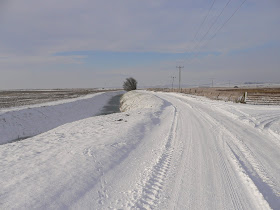
Following on from Part 1 of Sheppey's three islands, let us this time look at the Island of Elmley, although it has to be borne in mind that, just as the Isle of Harty, that despite having a tidal entrance at each end it was never actually seperated as such from the main island, Sheppey.
I apologise firstly, for the map below, which fails to show the mouth of Windmill Creek to the east of Elmley and alongside Spitend. However, looking at the map below, and the left hand side, you will see that Elmley Island begins as a small bay/inlet on the Swale side of the seawall. This inlet is directly opposite Ridham Dock and originally led into a part tidal/part freshwater creek known as The Dray.
The photo below shows The Dray as it is today, a wide fresh water fleet just inside the seawall. At the base of the photo is the top of the current sea wall.
This photo shows the seaward side of the entrance of The Dray, in effect seperated from The Dray by the dam that is the seawall. It is easy to imagine how it must of looked pre. seawall times, when especially on high Spring tides, the sea would have flooded inland along The Dray for some way.
Less than half a mile from The Dray's start above, this is how it currently crosses the Elmley track, as little more than a ditch, with low counterwalls either side. The counterwalls are the give away however, with the sea flooding in on a daily basis, it almost certainly must of been wider than it currently is, on a regular basis.
The Dray continues in this much reduced way for about a mile before eventually widening again as it approaches Southlees Marshes on the Minster side. Whilst it was always tradionally wider in that area, it has been much improved at this point in modern times by the farmer on its northern bank. The Dray here is now maintained in its wide and deep form and well fed with corn because the farmer on the Minster side leases that stretch out to a duck shooting syndicate because of the large numbers of wildfowl that he attracts.
Not far past here The Dray appears to peter out and that is because at the point designated on the map as Newhook Marshes it then became Windmill Creek, at its most inland point. However at this point and after the 1953 floods, that stretch of The Dray/Windmill Creek was used as, and filled in, as a Council Refuse Dump. The dustcarts would come in via Brambledown on the Leysdown Road, travel down via Poors Farm and deposit their loads. I remember when I first started rabbiting on Elmley in the early 1970's that the Dump had just come to the end of its life and was being levelled and grassed over and fenced in.
From there down to The Swale, Windmill Creek was, until 1953, tidal and there was even a small quay or two on the Eastchurch side that small sailing vessels used when delivering/receiving farm produce. There was a quay at Newhook for instance and I can clearly remember seeing it still there and un-used in the early 1970's.
The event that changed Windmill Creek for ever were the floods of 1953. These floods, the result of a high water storm surge pushed down the North Sea by gale force winds, flooded most of Eastern England and Holland with the loss of many lives, livestock and property. The low lying areas of Sheppey were particually badly flooded and Windmill Creek was one way that saw the counterwalls either side over-topped and the marshes flooded. Even in Sheerness, where I was a 6yr old boy, we had flood water part way up the stairs of our house and to the top of our gas cooker in the kitchen and the milkman delivered milk by boat in every street - we took in the milk by lowering a bag down on a rope from the bedroom window. From that event on the seawalls all round Sheppey were raised and at Windmill Creek a dam was built across the entrance, forever joining Harty with Elmley.
It eventually created on the inward side of the old Creek, a wide stretch of fresh water for a mile or so that was particually attractive to wildfowl, etc, and as I found out in the early 1980's, a brilliant source of flounders of all sizes!
That pretty much covers Elmley as an Island except for an historical event that ended on the Elmley side of the new dam. On September 7th 1940, at the height of the Battle of Britain, Flt. Lt. Hugh Berrisford in his Hurricane of 257 Sqd was shot down over the Thames Estuary and crashed into the marshes at Spitend, Elmley. In 1979 the Wealden Aviation Archaeolical Group identified the crash site and as part of a BBC TV programme, excavated the crash site. It was literally alongside the Dam on the Elmley side and because of the soft marshland soil the plane had gone in to a depth of 30ft. The dig however excavated much of the plane, alongside remains of the pilot's body. I can recall going to the site the day after the dig whilst on Spitend rabbiting and breaking open some lumps of mud and discovering part of Berrisford's check shirt, still buttoned up, in one of them
So, that is The Island of Elmley, created by both The Dray and Windmill Creek, from Ridham Dock all the way round to Windmill Creek near to Harty Ferry.
Monday, 27 December 2010
Sunday, 26 December 2010
Voluntary Restraint
Dawn this morning found me driving along the Harty Road with both the road and the surrounding fields glistening from a severe overnight frost. The sky was just starting to brighten and turn a light blue and along its horizon were those lovely pre-sunrise colours of pink and yellow.
Just as I went past the Raptor Viewing Mound the sky suddenly became full of wave after wave of geese, mainly Whitefronts and Barnacles, as they came out of the dawn sky and began to whiffle down into the fields either side of Elliots farmhouse. That magical clamouring of around a thousand plus geese calls was stunning and without wishing to get too romantic, the whole scene was like a typical Peter Scott painting coming to life.
Euphoric from such a start to the morning I made my way across the reserve to the seawall, to where the first reddening of the sky from the imminent sun was taking place - it was then that my day fell into depression - strung out along the short stretch of saltings in front of the reserve were 15 KWCA wildfowlers. Yes 15, which is more than I've seen on any one morning this whole shooting season and all despite a call by the shooting associations for a Voluntary Restraint on shooting because of the severe weather.
When severe weather is continuous, the shooting associations, in association with weather stations and government bodies, begin a countdown and on the 15th day of continuous severe weather (in this case Thursday 30th) a statutory ban on the shooting of wildfowl will come into place for to 14 days. In the meantime, from Day 7 a call is put out to all wildfowlers to take into consideration local conditions and where severe to show Voluntary Restrain and refrain if necessary from shooting where birds are seen to be weak or will be disturbed into burning up much needed energy flying around, disturbance relating to nearby waders as much as to wildfowl.
Now the whole of Harty is, and has been for some time, completely frozen up, with no free water and extremley limited feeding possibilities, the neighbouring farmers are in some places are putting out corn to attract ducks for shooting purposes, but I hardly expect that this is feeding most of the several thousand ducks that are currently in the eastern Swale.
I spoke to several of these wildfowlers and quite frankly they showed no remorse whatsoever for the wildlife in the area and didn't feel that they were doing anything wrong, which legally they weren't. But one thing that I do know, is that a lot of responsible KWCA members have actually stopped shooting because of the conditions and will no doubt feel quite let down now by these fellow members.
After that I felt so peed off that I went home.
Thursday, 23 December 2010
GEESE BONANZA
Yesterday afternoon (Weds) our four man team finally got round to carrying out the monthly Harrier Roost Count across Harty and Elmley, but first there was time to look at the huge geese flock assembling on the arable fields alongside the Harty Road. The Greylags were part of the local feral flock but on Tuesday large parties of White-fronted and Barnacle Geese had begun arriving and were feeding on snow covered fields of winter corn.
I took the following photo on Tuesday when the flock was half the size and although its not very good, if you double click on it and enlarge it you will be able to scan across the flock.
By yesterday afternoon the flock had built to a total of 1,100 White-fronted Geese, 149 Barnacle Geese, 300 Greylag Geese and 4 Pink-footed Geese and Whitefronts continued to cross the area up until dark. The count of both Whitefronts and Barnacles is exceptional in modern times for Sheppey and in respect of the Whitefronts, harks back around thirty years to when flocks of that size were seen fairly regularly on the Eastchurch marshes.
From there I moved onto the Swale NNR to carry out a count of any harriers going into roost on the reserve as dusk came in. Despite being in the relative shelter of the Tower Hide it became intensley cold as I waited an hour or so for birds to appear in an increasingly bitter N wind. In front of and below the height of the hide is one of the old salt workings mounds on which a few rabbits still live and if you double click the photo below you will see in the centre of it one of the reserve's special mammals - a black rabbit.
In the days when the reserve had a healthy population of rabbits we also had a healthy population of black rabbits and indeed they could be found across a lot of Harty, but not so anymore and this must be one of the last survivors on the reserve. Apparently they are a natural genetic colouration and surprisingly, despite obviously breeding with the normal colour ones, they always turn out as either jet black or brown, never a mixture.
Eventually I had three ring-tailed Hen Harriers move across the reserve but only one dropped into the saltings near Shellness Hamlet, to roost. The other two moved back off of the reserve. What the day's total roost count across Harty was, I don't yet.
The photo below shows one view from the Tower Hide and the bleakness of the landscape.
Monday, 20 December 2010
Snow on The Swale
DOUBLE CLICK EACH PHOTO TO ENLARGE IT.
With our Harrier Roost count cancelled yesterday and this morning's WEBS count suffering the same fate, both because of the severe weather and worries that the Harty Road running across the marshes might be a tad dangerous to navigate, I set off at 10.00 this morning in temps of -4 to investigate. I needed to get out after all day indoors yesterday.
Well as you can see from the photo below the road was indeed snow and ice covered and with a deep ditch to one side doesn't allow much leeway should you get into a slide but it wasn't quite as bad as it looked and I was driving a 4x4.
Rather than drive right down onto the reserve I left my car at Elliots Farm, by the side of the Harty Road, and walked down onto the reserve and made mt way across snow covered fields towards the seawall. The photo below shows the well frozen Delph Fleet alongside the seawall and part of the marsh to the left. In the distance you can just see the Seawall Hide.
As you will see below, on the top of the seawall I took a photo looking towards Shellness and with the saltings to the right - quite a bleak view don't you think.
However whilst I was there we had full sun and blue skies and despite it being a tad cold it was unexpectedly very picturesque. Unlike our mid-Kent cousins however, you can't still go out in woods and hedgerows in this weather and still see the same good numbers of a wide range of birds, the bleakness of the picture reflects how few birds that there were around, apart from out on the sea in the Swale itself. There most of the wildfowl had escaped too and in quite high numbers but on the marsh there were just a few small flocks of Skylarks and some thrushes along the boundary bushes.
As you can see below the snow was deep enough to cover all the grass and the cattle must of been wondering where and when their next meal was going to come from, probably not from the farmer's profits.
The view from the barn, back up the track to the reserve entry gate and with the snow making Midge look less white than she normally does.
Sunday, 19 December 2010
When I Was a Boy - The Old Days
Unfortunately I don't have any photos to illustrate this posting, my Kodak Brownie in those days didn't transfer to PC's that we didn't have anyway.
It's almost amusing though, as I sit here in my study on a chilly and snowy Sunday lunchtime, looking across to the Shingle Bank, the Thames Estuary and the distant Essex shoreline of Southend, to ponder on the current hysteria being whipped up by the media about a bit of snow. In my youth we didn't have the equipment to see multi-programmes on TV's or PC's giving us every angle on the snow situation throughout the country, no,all we knew was what was going on in the street outside and up the road, we just got on with what we could see.
For many of us over a certain age it seems almost silly to feel hard done by, molly-coddled as we are in centrally-heated houses with double glazing and cavity wall insulation. I for one, left school in the summer of 1962 and by the end of that year was working as a milk boy, accompanying a milkman on his round. Starting at 05.30 each morning wasn't pleasant at all and the empty milk bottles left outside overnight, were normally frozen to the doorstep. That aside, after leaving the fresh milk it would normally quickly freeze and stick out an inch above the top of the bottle with the foil cap sitting on top. That is because the first three months of 1963 saw one of the worst freeze-ups that we've ever had, with continuous snow and sub-zero temperatures well into March and the sea off of Sheerness freezing up and huge ice-flows and dead birds along the beach. Indoors, the only warm room was the lounge where the only fire was, but upstairs the bedroom windows had ice on the inside almost continuouslly for months on end and we often slept in our clothes to keep warm.
And to come back to current times and the much-hyped latest "Freeze Up", how many people must of noticed as I have, how at a time when power use is at its highest, how in these windless conditions the wind turbines aren't going round and aren't creating Green Power - one of the drawbacks of having Green Energy forced upon us at huge profits to the developers - it just doesn't happen!
And also, how I wonder how all those new species of wildlife that have been seduced into coming here because of so-called Global Warming's mild winters, must be regretting the decision to come here - if they're still alive.
No, to summarise, this current drop of cold weather is pretty lightweight, unless of course it continues in this form for three months.
Friday, 17 December 2010
Sheppey's Three Islands (Part One)
People looking at the map of Sheppey might be surprised to see that it mentions two other Islands, those of Emley Island and the Isle of Harty. That is because some few hundred years ago, before the current seawalls were built, the above two islands were indeed seperated from Sheppey by part-tidal fleets Windmill Creek and The Dray at Elmley and Capel Fleet at Harty.
Let's start at Harty and if you look at the map below you can see most of Capel Fleet as it wriggles its way round the marshes, originally near Shellness in the east and off-map, at Windmill Creek in the west. Capel Fleet was tidal at both ends and for part of its length from each end and it was only the construction of the current seawalls that effectively dammed it's two ends and stopped the daily inward flow of seawater. Before that and for much of length it had on both sides, low counterwalls that would protect the flat marshes from regular flooding from either Spring tides or winter rains. If you walk about three quarters of a mile along the seawall from Shellness towards the Swale NNR you come to a sharp bend in the seawall and here you will be able to see why on the map, that Capel Fleet seems to end almost a mile short of the seawall.
Running away from the seawall and in a straight line across the nature reserve, is a low counterwall (see the photo below) and before the existing seawall was built this counterwall was in effect the old seawall bordering the tidal saltings as Capel Fleet ran inland. This counterwall was originally on both sides of the Fleet but only a few yards remains of the eastern side. What is interesting in the two photos below is the fact that the grazing land to the immediate right of the counterwall was originally saltings, exactly as there still are on the seaward side of the seawall. After the seawall effectively dammed off Capel Fleet from the sea these saltings gradually dried out and grassed over but there is still evidence snaking through the field, of the shallow depressions left of what would of originally been the deep and muddy reel-ways of the saltings. Sadly, all that remains of Capel Fleet for this stretch is a tiny ditch that seperates the nature reserve from the farmland alongside.
So, this stretch of now non-existent Capel Fleet stretches across the nature reserve and across the new RSPB fields until it reaches the track running down from Muswell Manor and here it reaches the first remains of how it used to look and although its wide width is concealed now by wall to wall reed beds, it runs in its original form all the way round to the Raptor viewing Mound on the Harty Road. Between the Raptor Viewing Mound and Capel Corner at the foot of Capel Hill, it peters out again and is little more than a ditch that only re-floodes to its former width in very wet winters. However along this ditch-like stretch it is noticeably bordered on both sides by its original counterwalls and one of them serves two purposes, not only did it serves as a low counterwall to protect the marshes from being flooded by the Fleet, but its top also doubled up as the way across the marsh, it is the Harty Road. This explains why it is in such poor condition these days, it was only intended as a footpath and cart track, it was never built with foundations capable of sustaining the regular passage of huge and heavy farm tractors and lorries as it now has too.
Finally, and sorry about the darkness of the photo, at Capel Corner we see the last stretch of Capel Fleet in the form that it basically continues in all the way round to Windmill Creek and the seawall again. This is the Capel Fleet that most people are familiar with these days and is pretty much how it would of looked along its whole length once apon a time when it was creating the Isle of Harty.
(I will describe how Elmley Island was formed in Part Two)
Monday, 13 December 2010
A Different View of Things
Since my last posting it has been diificult to find something to write about. The reserve remains a mixture of empty ditches and being frozen solid and whilst the high tide roosts of waders at either extremity are still quite huge, the marshland middle part of the reserve remains depressingly quiet birdwise. In fact we seem to have arrived at a rare situation whereby, due to dryness, in the middle of winter a wetland reserve seems to have more passerines than wildfowl or waders.
Once again the only wildfowl present are the ducks congregated in the tiny unfrozen section of the Delph fleet along the seawall, where from unfortunately, they are being shot as they fly over the seawall, by the wildfowlers. That also brings me round to something I also touched on in my last posting, my E-Mail from a guy who supports the Kent Wildfowlers (KWCA). We continued, and still do, to exchange E-Mails on the subject of duck shooting on Harty and it became quite surprising to me as the E-Mails flew to and fro, how much we had in common to a degree, despite currently being from either side of the fence so to speak. There is worse going on than the limited nature of wildfowling.
Now, before you all rise up and scream "oh my god", I haven't been bought out and I will never cede that a wetland nature reserve can share itself with those people trying to kill its wildlife such as at The Swale NNR and Oare nature reserve, but I have through our written conversations seen reason to moderate my views on shooting in some areas. The main reason that we have arrived at the above in my opinion is purely down to the conservation bodies not being assertive enough and the wildfowlers happily exploiting that fact.
One thing that myself and the guy from the KWCA did end up doing as we moderated our opposition to each other's views was to swap experiences gained from close on sixty years being involved in a wide variety of countryside pursuits, something that perhaps many nature reserve wardens are lacking in. Lets face it, in my time I've been a rabbit trapper, eel catcher, even tried wildfowl shooting for one season in the early 1970's and now I'm into wildlife conservation, like my fellow E-Mailer, that's a pretty good education from which to comment from. The one thing that I did eventually agree with this guy on was that, if we are to be totaly honest and lay blame on the wildfowl shooting that is going on out there, then there is actually worse than the wildfowlers. The commercial, for profit, duck shooting that is now being championed by the landowners out there, is having a far more devastating effect on the wildfowl numbers than the few birds being taken by the true wildfowlers.
Now I rather feel that this is currently perhaps 1-0 to his points of view but he knows that I will never relax my opinions on the shooting directly in front of the reserves but I'm happy that our shared lifetimes on the marshes does find us with similar views on how it could or should be.
Now, on a different subject all together, whilst going through my photograph collection I found these two photos. The first is a poor quality view of the old Elmley church and the second is a bit of action at the old Elmley Ferry across to Murston, sadly long gone as a means of access. The was even a time when the children from Kingshill Farm used this ferry to go to school at Murston on the mainland, imagine how many times they got cold and wet and compare it with today's mollycoddled children that have to be driven to school and can't go if there's a few flakes of snow because the school staff see it as an excuse for a day off - out in the snow with their own children!
Tuesday, 7 December 2010
STILL FROZEN
While the reserve still remained frozen solid this morning the sight of patches of blue sky and some watery sun made it far more enjoyable to walk round than in yesterday's awful gloom and skin-numbing freezing fog.
Below you will see the "Seawall Hide" which sits facing the reserve just a few yards from the seawall. In a normal, wet winter the field in front of this hide floods up to as much as 70% of its area, attracts many hundreds of wildfowl and waders and is known as "The Flood".
Although you can't see it in the photo, underneath the hide someone has trod a trail the few yards to the edge of the Delph dyke. Just to the left of the hide there is the only area of water left un-frozen on the whole of the reserve.
This photo shows that tiny area of water, about 30 yds in diameter, with it's attendant Mallard, perhaps the reason "someone" hid in the reeds under the hide.
The view in the opposite direction from the "Seawall Hide", looking over the seawall, across the saltings that are shot and out to the Swale.
Nana, my 15 yr old Beagle having one of her now not so frequent visits to her old stomping ground along the seawall.
I had an E-Mail from a guy this morning, who has E-Mailed me before on the subject of my dislike of the wildfowlers. I don't believe that he still shoots anymore himself but he still supports the Kent Wildfowlers and what they do. Whilst there is little chance of us agreeing on the subject, I respect his opinions and the fact that he is bothering to voice them, that's how it should be and we share some interesting opinions.
He took me to task over the current Severe Weather voluntary shooting restraints and a potential ban and the fact that the poor attitudes of those wildfowlers that I had spoken too weren't necessarily those of the majority of the KWCA members. Well I can accept that, there are indeed bad apples in any organisation - we in birdwatching circles have twitchers - but I can only write about what I see and experience.
I know that he, and presumably even birdwatchers, given the deafening silence from the majority, feels irked that I keep hammering away at this legal "sport" but I'll never be able to accept that it should take place on, or against a wetland nature reserve.
Bird-life on the reserve was fairly limited but I did scrape up the following as I walked round the marsh.
2 Heron - 1 White-fronted Goose - 80 Greylag Geese - 30 Mallard - 1 Marsh Harrier -1 ring-tailed Hen Harrier - 1 Sparrowhawk - 2 Kestrel - 20 Lapwing - 1 Barn Owl - 70 Skylark - 30 Mipits - 20 Linnet
Saturday, 4 December 2010
A BIT OF A THAW
When I went to bed last night the outside temerature was -6 and yet when I got up at 06.00 it had risen to +3 and not only that, it had rained hard for a while. As a result the road outside my house was visible again and ice free and the snow in the garden had reduced in height. +3 a week ago at 06.00 would of seemed bloody cold, this morning it felt balmy, and so after three days stuck indoors sheltering from the cold, which I hate, I was off to the reserve with Midge.
I was a bit nervous about the one car wide Harty Road that winds its way across the marsh, not so much because of the ice on it but the fact that on one side there is a very deep ditch and one uncontrolled slide would be curtains, but even there the ice was becoming slushy and so I reached the reserve surprisingly easily. There I was once again surprised at how much green grass was showing through the snow, quite clearly a combination of the rain and less snow at that end of Sheppey had produced results.
After setting off round one of the reserve tracks that you can see below, the first bird that I heard and then briefly saw, was a Lapland Bunting, a great start.
I then made my way across the marsh below and headed for the Delph fleet alongside the seawall and as I reached the crossing that crosses that and headed up onto the seawall, I flushed the first Woodcock for the reserve this winter - great stuff, I wasn't expecting all this, and in the conditions, two birds even!
On stepping on to the top of the seawall I had hoped that saltings in front of me would be devoid of wildfowlers - frozen conditions, lack of food and birds in poor condition - but of course wildfowlers don't have compassion like the rest of us and there were five of them strung out along there - hopefully freezing their bits off.
Now for those of you that don't know about these things, in severe weather, from an appointed day and taking advise each day from a chain of weather stations countrywide, the days begin to tick towards Day 13 of continous freezing weather, when the Government will then sign a document to ban the shooting of wildfowl from DAY 15 and for fourteen days after.
Today should of been DAY 7, when wildfowlers were asked to show voluntary restraint ahead of the ban, but as they will, because we had a slight thaw today, the DAY number remained at DAY 6 pending the weather tomorrow. From past experience out there, and talking to a couple of the guys there this morning, no one bothers with voluntary restraints and the only thing that will stop them shooting poorly wildfowl is a compulsary ban after DAY 15 - one day someone will wake up to these pratts and their attitude towards wildlife.
Anyway, another sermon on nature reserves being inhabited by wildfowlers is over and I then went back onto the marsh as you can see below. Here I witnessed one of those spectacular wildlife events, I watched a Merlin pursuing a Mipit across the saltings. Round and round and up and down the two went and every time that I thought the Merlin was just about to snatch the Mipit, the smaller bird jinked enough to be missed. Eventually the lucky Mipit dropped like a stone into a reed bed and the Merlin gave up and flew off - great stuff.
Apart from an odd Skylark and a couple of Mallard that was pretty much all the birds about out there early this morning but, to be honest, a Lapland Bunting, Woodcock and Merlin were good enough for me.
One last photo shows my poor, neglected bird feeders in the garden. They've been like that almost all the time through the cold weather, I think that birds round here must be better fed elsewhere and so I don't get bird feeder photos like Warren -I'm sure he's got loads of stuffed birds and puts them on the feeders - I keep looking at his photos to see if I can recognise the same bird in the same pose.
Thursday, 2 December 2010
RAF EASTCHURCH
With around 18" of snow here on Sheppey today I haven't bothered to go out and so what could I write about. Well, as you may know from previous blogs, I have in my past researched and written up the complete history of aviation here on Sheppey. Today I will give you a tiny and much abridged flavour of the beginning of the Second World War at Eastchurch. (Sorry about a line of rubbish by one photo, which I couldn't correct)
There had been an airfield there since 1910 and an RAF one since 1918, when the RAF was formed. Prior to 1940 Eastchurch had merely seen a succession of various training schools but by mid-1940 and the imminent threat of attack by the Germans these Schools had been sent away and after just one day under the command of Fighter Command, Eastchurch had been transferred to No.16 Group - Coastal Command and in came a squadron of Blenheim bombers and two squadrons of Fairey Battle light-bombers, for cross-channel operations.
Jumping forward now to the 13th August 1940, this was the day that Germany made its first proper attack on England. After taking off from French airfields at 05.10 that morning several German bomber squadrons joined up and headed across the Channel. Almost immediately attempts were made to recall them due to bad weather but this was not totaly successful and so 74 Dornier bombers continued towards Kent without their fighter escort. To avoid detection one Gruppe skirted round the Kent coast and came in from the Thames Estuary and headed in towards Eastchurch at 10,000 feet. At 06.45 they were attacked by Spitfires of 74 Squadron, with little success and the Gruppe split up with one party heading to Sheerness Docks and the other to Eastchurch.
The Station Commander at Eastchurch was woken up by a phone call from the Royal Observer Corps at Bromley saying " we think that there may be some bandits bound for you" and no sooner had he pulled on his boots when the bombs came raining down from 9,000 feet. At 07.00 two vics of fifteen Dorniers had begun bombing the airfield from south to east and also strafing the airfield with machine guns and by 07.20 it was all over, with more than one hundred high explosive bombs dropped.
As people began emerging from hangars, sleeping quarters and shelters there was a scene of shocked carnage and this was to be repeated several times over the next few weeks with even worse effects.
Below is a photo of three Armourers at the airfield during June 1940 and before it all kicked off.
Two of the above guys - Richard Moss and a friend - having a snack in front of the camouflaged hangars in June 1940
The same hangars after the raid
Some of the airmen's quarters after the raid.
a href="https://blogger.googleusercontent.com/img/b/R29vZ2xl/AVvXsEh1ksO9zzo-tq2OnHR6ne9Zf47Q282xxphg0wb8aQCHGgWoI1k7meiJG_r4PnAhve62pl_m73q0ZP5z_UV-lGOA2ammWk3IYEFLh5jQX_rpCFcWdzQXjirin7i5B0dJVSojujtarPyeSfFu/s1600/AUG404.JPG">
More of the airman's quarters
The body of a shot down Dornier's crew member being recovered from the mudflats off I believe Herne Bay/Seasalter.